All-constellation tracking
GPS, GLONASS, BeiDou, Galileo, QZSS, NavIC, and SBAS — 672+ channels with update rates up to 20 Hz.
Navya · Hardware
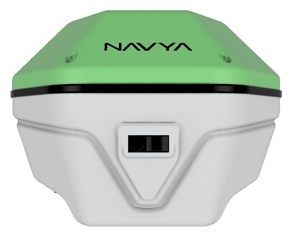
A rugged, high-precision GNSS receiver built for surveyors, engineers, and field teams who can’t afford to guess. Precision redefined.
Built for the field
Multi-frequency tracking, IMU tilt compensation, integrated laser positioning, and all-day battery — engineered for Indian field conditions.
GPS, GLONASS, BeiDou, Galileo, QZSS, NavIC, and SBAS — 672+ channels with update rates up to 20 Hz.
0°–45° tilt in RTK mode with ±0.4 mm/degree compensation so poles don’t need to be perfectly plumb.
Integrated rangefinder accuracy ≤ 5 cm at 50 m range (≤ 45° tilt in RTK mode) for hard-to-reach points.
10,000 mAh Li-ion — up to 24 h rover, 16 h base, 12 h laser mode. USB-C charging & data.
IP67, −40°C to 65°C operating range, MIL-STD-810G vibration/shock, NABL-accredited testing.
Bluetooth 5.0, Wi-Fi, NMEA-0183 output, and seamless control from the Navya Fields Android app.
Product specification
Receiver, positioning performance, communications, physical, and power — as published in the Navya product brochure.
| GPS | L1, L1 C/A, L2, L2C, L2E, L2P, L5 |
|---|---|
| GLONASS | L1, L2, L2 C/A, L2P, L3 |
| BeiDou | B1, B2, B2a, B2b, B3 |
| Galileo | E1, E5a, E5b, E5ab, E6 |
| SBAS | WAAS, EGNOS, BDSBAS, MSAS, GAGAN, SDCM |
| QZSS | L1 C/A, L1C, L5, L2C, L6 |
| NavIC | NavIC L5, L-Band |
| Channels | 672+ channels |
| Update rate | Up to 20 Hz |
| Memory | Internal 64 GB |
| RTK & PPK baseline | Up to 100 km |
| PPP | Any point on Earth |
| IMU positioning | 0°–45° tilt compensation (RTK); ±0.4 mm/degree |
| Laser positioning | ≤ 5 cm (50 m range, ≤ 45° tilt in RTK) |
| High precision static (phase) — long observation | 2 mm + 0.1 ppm H / 3.5 mm + 0.4 ppm V |
|---|---|
| Fast static / PPK | 4 mm + 0.5 ppm H / 8 mm + 0.5 ppm V |
| Real-time kinematic (RTK) | 7 mm + 0.5 ppm H / 14 mm + 1 ppm V |
| Tilt RTK | RTK + 5 mm + 0.4 mm/° |
| RTK network / CORS | 7 mm + 0.5 ppm H / 14 mm + 1 ppm V |
| PPP | 4 cm + 1 ppm or better with network RT (H+V) |
| Laser RTK | ≤ 5 cm (50 m, ≤ 45° tilt) |
| DGPS | 25 cm + 1 ppm RMS H / 40 cm + 1 ppm RMS V |
| SBAS | Typically < 2 m 3DRMS |
| Bluetooth | Bluetooth 5.0 wireless connectivity |
|---|---|
| Wi-Fi | Built-in 2.4 GHz, 802.11 b/g/n |
| Network | 4G via certified Android controller — TDD-LTE / FDD-LTE / WCDMA / GPRS / GSM |
| USB | USB Type-C for charging & data |
| NMEA output | NMEA-0183 over Bluetooth for external devices |
| Startup time | 5 seconds |
| Radio range | 8 km in open area |
| Data formats | RTCM 2.3 / 3.0 / 3.1 / 3.2, MSM, NTRIP, NMEA-0183, RINEX |
| Dimensions | 100 mm (H) × 132 mm (W) × 140 mm (L) |
|---|---|
| Weight | 730 g |
| Operating temperature | −40°C to 65°C |
| Storage temperature | −40°C to 85°C |
| Ingress protection | IP67 waterproof & dustproof |
| Humidity | 5% to 95% non-condensing |
| Compliance | IEC-60529 dust & water; MIL-STD-810G vibration/shock; NABL-accredited lab |
| Battery | Rechargeable Li-ion 10,000 mAh (included) |
| Operating period | Rover 24 h · Base 16 h · Laser 12 h |
| Charging time | ≈ 8 hours |
Specifications from the official Navya brochure. Performance figures assume proper installation, clear sky view, and suitable corrections. Contact Alpha Geosystems for configuration options and accessories.
Complete the stack
Alpha Geosystems · Gurgaon · info@alphageosystems.in · +91 124 4931212
© Alpha Geosystems · 603, Tower A, Unitech Business Zone, South City II, Sector 50, Gurgaon 122018, Haryana, India · M: +91 9811423111