Powered by a leading SLAM algorithm, the S1 builds your reality as you scan. Capture indoor and outdoor environments as you walk, and view real-time point clouds on your mobile device. See your surroundings come to life with every step, so you don’t miss any details.
A New Way to Scan the World
Powered by a leading SLAM algorithm, the S1 builds your reality as you scan. Capture indoor and outdoor environments as you walk, and view real-time point clouds on your mobile device. See your surroundings come to life with every step, so you don’t miss any details.
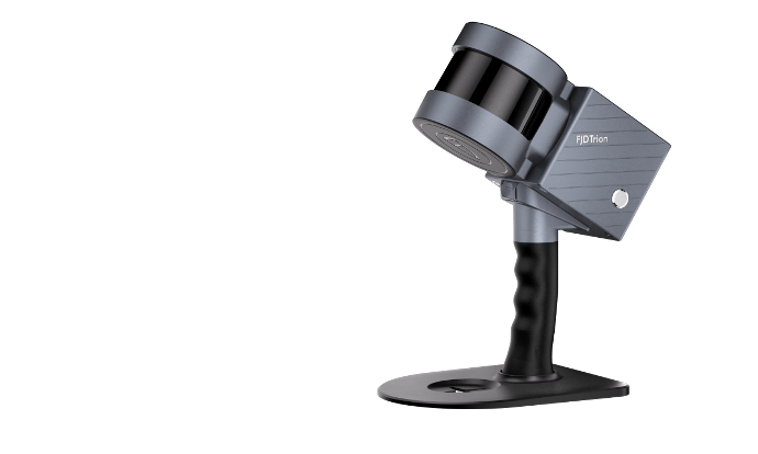
Ready, Set, Scan
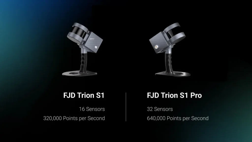
Reliable Accuracy
Scan a 100 m²/1,000 sq ft area in just 2 minutes, and achieve 2 cm of relative accuracy with post-processed reconstruction models.
*Tested in experimental environment
Long-Range Measurement
Featuring a built-in LiDAR 3D scanning technology, the S1 allows you to capture precise measurements of complex objects and shapes in various dimensions and generate 3D models in one scan.
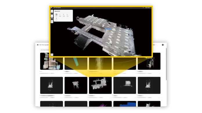
Seamless Integration into FJD Trion Software Ecosystem
Streamline the workflow from point cloud capture, data processing, to deliverable sharing, giving you a smooth project experience.
FJD Trion Scan
Data collection
Real-time app control. Scan file management
FJD Trion Model
Data Processing
Generate construction, forestry, mining reports, and more.
With its hot-swappable dual batteries, the S1 ensures uninterrupted power supply. Get 4 hours of work with both batteries.
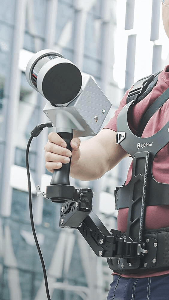
Explore Multiple Configurations
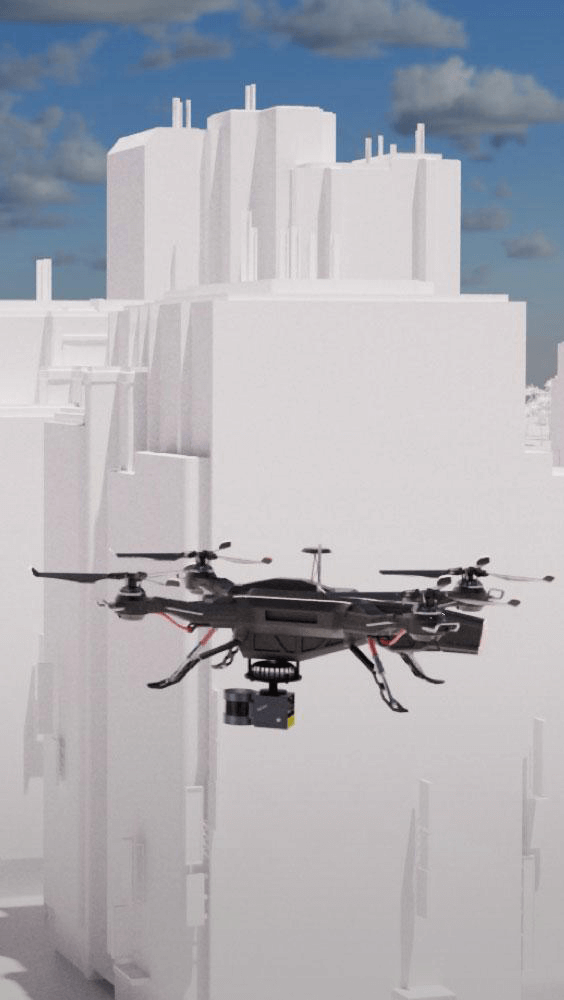
Use FJD Trion S1 in indoor, outdoor and underground environments, even in the sky with drones, as it is lightweight and portable.
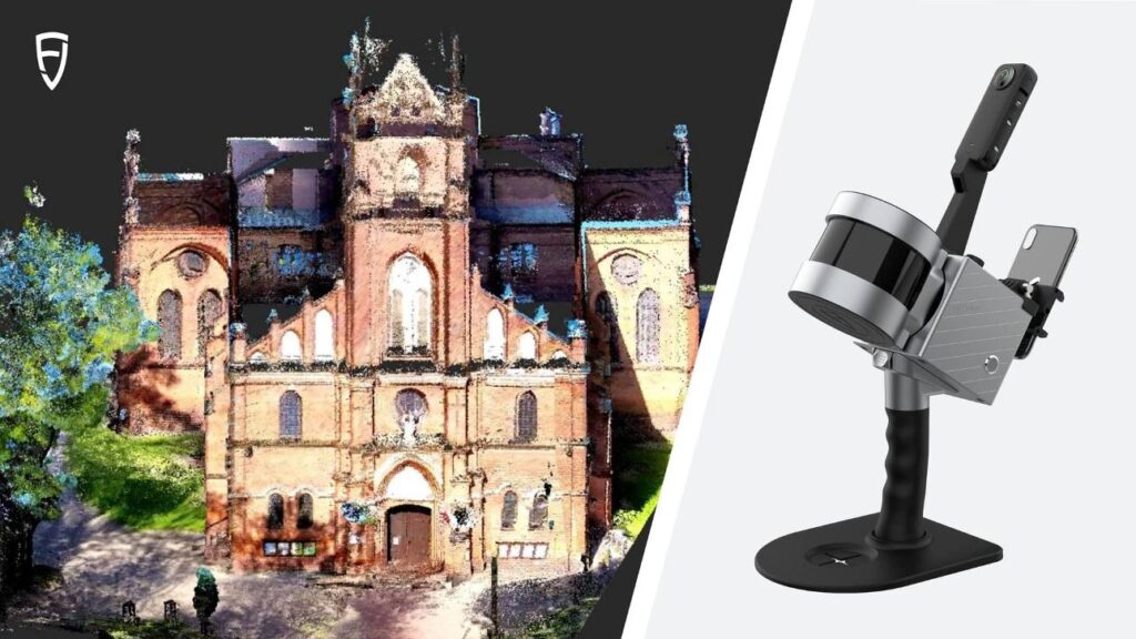
Handheld
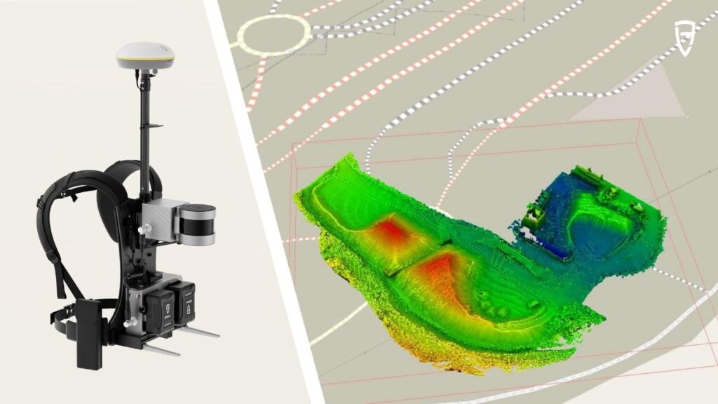
Backpack
Drone
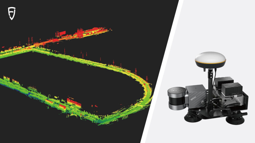
Car Ship
Accessories to Expand Your Capabilities
This optional add-on panoramic camera provides RGB and texture information to your point clouds and mesh, so you can bring more reality to life.
Pair the backpack with the FJD Trion V1t RTK Rover for geo-referenced point clouds with centimeter-level accuracy. Perfect for outdoor mobile scanning projects, this combination eliminates the need for external control points.
Combine the carmount with RTK to showcase exceptional data-gathering capabilities and generate precise geo-referenced point clouds with centimeter-level accuracy.
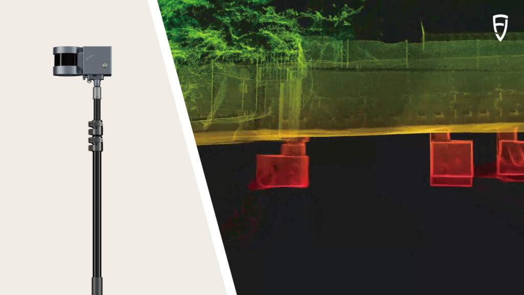
Mount your laser scanner onto the extension pole to map spaces that are hard to reach, like ceiling voids, volume checks, infrastructure inspection, and stockpile analysis.
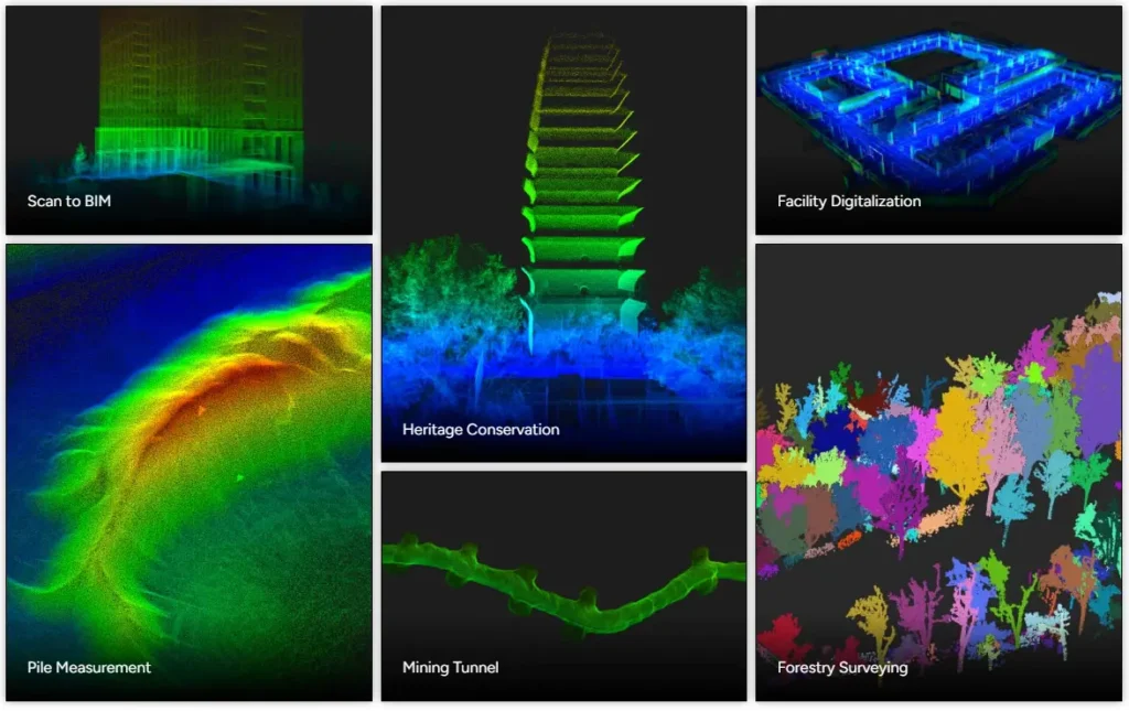
Application Scenarios
The S1 is designed for both indoor and outdoor scanning, making it perfect for a wide range of scenarios.
Reliable Service and Monitoring Instruments You Can Trust
Discover our wide range of Service and monitoring instruments—designed for accuracy, built for tough conditions, and trusted by professionals worldwide.